

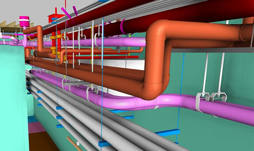

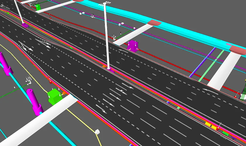

Civil and Infrastructure As-Built Documentation Services
Endeion provides civil as-built documentation services for transportation, utility, water, site-development, and public infrastructure projects. Our role is to convert approved field records, survey information, redlines, contractor markups, point cloud data, and final construction updates into organized project records that reflect the completed asset.
Infrastructure closeout requires more than a revised plan set. Owners, engineers, contractors, municipalities, and facility teams may need to coordinate record plans, BIM models, utility information, survey-referenced data, sections, profiles, schedules, and supporting closeout documentation. Endeion structures these deliverables around the project scope so the final information can support handover, future maintenance, rehabilitation, expansion, and asset management.
Our infrastructure as-built documentation focuses on civil and public works environments such as roads, bridges, tunnels, rail corridors, grading and drainage systems, underground and overhead utilities, water and wastewater networks, and related infrastructure assets. General architectural drafting and building-focused MEP documentation are not the primary focus of this service.
What Are Civil As-Built Documentation Services?
Civil as-built documentation services capture the final constructed condition of infrastructure after changes made during construction have been incorporated into the project record. The documentation may show final alignments, elevations, utility routes, drainage components, structural changes, grading conditions, installed equipment, and other information needed to understand what was actually built.
Unlike design drawings, record information should reflect approved construction changes and verified field data available at project closeout. Endeion develops the documentation from the information supplied by the project team, such as redlines, survey data, inspection records, approved RFIs, revised drawings, contractor markups, point clouds, and final model files.
A complete as built documentation service can include both 2D and model-based outputs. The exact package depends on agency requirements, owner standards, project delivery method, and the quality of the field information available.
Infrastructure As-Built Documentation We Provide
2D Record Plans and Final Construction Drawings
Endeion updates civil construction drawings to reflect approved field changes and final installed conditions. Record plans can include plan views, profiles, cross sections, details, elevations, schedules, and annotation updates. For public infrastructure, these records help owners retain a clear history of the completed work and provide a reference for maintenance or future design.
BIM and 3D As-Built Models
Where a model-based deliverable is required, Endeion can develop or update BIM and civil 3D models from approved project data. Models may represent transportation corridors, structures, tunnels, utilities, treatment facilities, or other civil assets. Model content, level of detail, coordinate requirements, and data fields are defined before production, so the deliverable matches its intended closeout or asset-management use.
Utility Record Documentation
Utility records are critical for future excavation, maintenance, tie-ins, and expansion. Endeion can document water, sanitary sewer, stormwater, electrical, telecom, gas, fuel, and other underground or overhead systems based on approved field information. Where supplied, the documentation may include locations, sizes, materials, invert elevations, rim elevations, manholes, valves, structures, crossings, connection points, and station or offset references.
Survey and Geospatial Data Integration
Civil closeout packages frequently depend on survey-controlled information. Endeion can incorporate client-provided survey files, coordinates, elevations, point data, geospatial references, and field measurements into drawings and models. The source survey remains the controlling field record; our role is to translate and organize that information into the agreed documentation format.
Scan-to-BIM and Point Cloud Documentation
For existing or complex infrastructure, point cloud data can provide a detailed reference for final conditions. Endeion can process suitable scan data into coordinated 3D models and extract record views, sections, and other deliverables. This can be useful for tunnels, stations, treatment facilities, bridges, plant areas, and rehabilitation projects where existing conditions need to be documented before future work.
Closeout and Handover Documentation
Project closeout may require more than drawings. Depending on the contract, Endeion can help organize model files, final drawing sets, utility records, data schedules, revision references, and related documentation into a clear handover package. The required naming, sheet standards, formats, and acceptance criteria should be established from the owner or agency requirements at the beginning of the assignment.
Civil Infrastructure Project Types We Support
Roads and Highways
Roadway record documentation may include final horizontal and vertical alignments, pavement limits, lane configurations, curbs, sidewalks, signage, traffic-control elements, drainage structures, and utility crossings. Profiles, cross sections, details, and final surface information can be updated from approved construction and survey records.
Bridges and Structural Infrastructure
Bridge and structural infrastructure records can document final geometry, foundations, piers, abutments, decks, retaining structures, structural steel or concrete elements, expansion joints, and related components when those details are included in the source records. The resulting documentation supports inspections, rehabilitation planning, and future modifications.
Tunnels and Underground Structures
Tunnel projects require clear records of geometry, lining, portals, drainage, utilities, service areas, access routes, and structural interfaces. Endeion can prepare plan, profile, section, and model-based documentation from supplied construction updates, surveys, or scan data to support long-term infrastructure management.
Drainage and Stormwater Systems
Our infrastructure as-built documentation can cover storm drains, culverts, inlets, catch basins, manholes, channels, detention or retention features, outfalls, and related structures. Where field data is available, drawings can record pipe sizes, slopes, invert elevations, structure IDs, and final routing.
Grading and Site Development
For grading and site-development projects, record plans may show final contours, spot elevations, slopes, pads, retaining walls, access roads, earthwork limits, and site drainage relationships. Survey-based final surfaces can be incorporated where they are provided as part of the project record.
Underground and Overhead Utilities
Utility as-built documentation can record installed routes, crossings, structures, connections, and key field data for water, sewer, storm, power, telecom, gas, and other networks. This information is especially valuable for future maintenance, utility locating, upgrades, and corridor coordination.
Railways and Transit Infrastructure
Rail and transit closeout documentation can support track-related civil works, stations, utility corridors, drainage, structures, access routes, and associated public infrastructure. Final deliverables are prepared from the approved project records and can include plans, profiles, sections, models, and utility information.
Water, Wastewater, and Public Infrastructure
Endeion can support record documentation for water and wastewater systems, pump stations, treatment facilities, public works sites, and related infrastructure assets. The scope may include pipelines, structures, grading, drainage, civil layouts, and asset-related model information required for handover.
What a Complete Civil As-Built Record Can Include
| Deliverable | Typical Civil / Infrastructure Content |
|---|---|
| Record Plans | Updated site, roadway, utility, drainage, grading, structural, plan/profile, section, and detail sheets. |
| BIM / 3D Models | Final-condition models developed or updated to the agreed geometry, information, coordinate, and file requirements. |
| Utility Data | Routes, structures, connection points, sizes, elevations, IDs, and other field information when supplied. |
| Survey Information | Coordinates, elevations, final surfaces, field points, and geospatial references provided by the project team. |
| Point Cloud Outputs | Scan-derived models, sections, plans, or references for existing and final conditions when point cloud data is available. |
| Closeout Records | Organized drawing sets, model files, schedules, revision references, and other agreed handover documentation. |
Our Civil As-Built Documentation Process
1. Project and Closeout Requirement Review
We review the contract requirements, owner or agency standards, final deliverables, coordinate system, file formats, project schedule, and acceptance criteria.
2. Source Record Assessment
Our team reviews approved drawings, redlines, RFIs, field markups, survey files, inspection notes, existing BIM models, point clouds, and other closeout information supplied by the project team.
3. Record Data Organization
Changes are organized by discipline, asset, sheet, location, revision, or model element, so the documentation workflow has a controlled reference set.
4. Drawing and Model Updates
Civil plans, profiles, sections, utility layouts, grading information, structural records, and BIM models are updated from the approved source of information.
5. Survey and Utility Data Integration
Where applicable, coordinates, elevations, structures, pipe data, final surfaces, and utility references are incorporated from the supplied field or survey records.
6. Quality Control Review
Deliverables are checked for consistency with source records, sheet organization, model alignment, naming, coordinates, annotations, data completeness, and required file standards.
7. Final Closeout Delivery
The completed drawings, models, and supporting records are delivered in the agreed formats for owner, agency, contractor, or asset-management of use.
Source Information We Can Work From
The reliability of any record package depends on the quality of the source information. Endeion can work with a combination of the following project records:
- Field redlines and contractor markups
- Issued-for-construction and revised civil drawings
- Survey points, coordinates, elevations, and final surface data
- Utility locate records and approved utility information
- Inspection notes, approved RFIs, change records, and field sketches
- Existing Civil 3D, Revit, Navisworks, CAD, or other agreed project files
- Point cloud and laser-scan data
- Owner, DOT, municipality, transit agency, or utility closeout standards
Where field information is incomplete or conflicting, Endeion can identify the documentation gap for client review. We do not invent unverified final conditions. Any licensed surveying, engineering certification, or agency sign-off remains with the responsible project professional unless separately contracted.
How Civil As-Built Documentation Supports Project Closeout
- Creates a consolidated record of final construction conditions and approved changes.
- Provides future design teams with a clearer reference for rehabilitation, widening, upgrades, and tie-ins.
- Improves utility and asset visibility for maintenance and excavation planning.
- Supports owner, municipality, DOT, transit, utility, and public-agency closeout workflows.
- Preserves survey, model, and drawing information in formats that can be reused after construction.
- Supports asset management and facility or infrastructure lifecycle planning when the required data is included.
As-built documentation services are most useful when closeout requirements are defined early. A clear record strategy helps project teams collect the right survey, utility, change, and model of information throughout construction rather than trying to reconstruct it at the end.
Quality Control for Infrastructure As-Built Documentation
Civil record documentation must remain traceable to the approved field information. Endeion applies structured checks appropriate to the project’s scope before delivery.
- Sheet, profile, section, and detail consistency
- Coordinate, datum, grid, stationing, and elevation alignment where applicable
- Utility route, structure, and attribute checks against supplied records
- Drawing-to-model consistency for coordinated deliverables
- Revision, naming, layer, style, and file-organization checks
- Cross-reference review between plans, profiles, schedules, and supporting data
- Final file-format and submission-package review
These checks support a dependable documentation package but do not replace licensed survey certification, engineering approval, owner acceptance, or regulatory review. Final compliance and acceptance remain subject to the requirements of the governing agency and project contract.
Why Choose Endeion for Civil As-Built Documentation Services?
Civil and Infrastructure BIM Experience
Endeion’s civil services cover infrastructure BIM, coordination, shop drawings, quantity workflows, and as-built documentation, helping our team understand how closeout information connects to earlier project stages.
2D and Model-Based Delivery
Projects can require traditional record plans, 3D BIM models, survey-based records, utility data, or a combination of formats. We define the package around the intended downstream use.
Support for Complex Infrastructure
Our documentation workflows can support roads, bridges, tunnels, drainage systems, grading, utilities, rail-related projects, treatment facilities, and other public infrastructure.
Structured Project Inputs
We work from approved drawings, field records, surveys, redlines, point clouds, and existing project models rather than making assumptions about final construction conditions.
Flexible File and Documentation Workflows
Endeion works with tools used across BIM and civil delivery, including Revit, Civil 3D, Navisworks, CAD, and point cloud workflows, subject to the project requirements.
USA and Global Delivery Support
With headquarters in Virginia and delivery resources in Canada and India, Endeion can support USA-based infrastructure teams as well as international project workflows.
FAQs About Civil As-Built Documentation
What are civil-built documentation services?
Civil as-built documentation services create a final project record that reflects approved construction changes and field conditions for infrastructure assets. Deliverables can include record plans, profiles, sections, BIM models, utility information, survey-referenced data, and closeout files.
What infrastructure projects can Endeion support?
Endeion can support documentation for roads, highways, bridges, tunnels, grading and drainage systems, water and wastewater networks, underground and overhead utilities, rail-related infrastructure, treatment facilities, site-development work, and other public infrastructure projects, depending on the available source information.
Can Endeion prepare utility as-built records?
Yes. Utility documentation can include water, sewer, stormwater, electrical, telecom, gas, and other networks. The record can show routes, structures, connection points, sizes, elevations, and other attributes when that information is provided through approved field or survey records.
Can survey information be incorporated into the final record plans?
Yes. Client-provided survey points, coordinates, elevations, final surfaces, and geospatial references can be incorporated into drawings or models. The survey data remains in the controlling field source, and any required survey certification should be provided by the responsible, licensed surveyor.
What is the difference between record plans and construction drawings?
Construction drawings communicate the approved design before and during construction. Record plans document the final constructed condition using approved redlines, field changes, survey information, and other closeout records.
Can Endeion create BIM models for infrastructure closeout?
Yes. Where required by the project scope, Endeion can develop or update BIM and civil 3D models from approved drawings, survey information, point clouds, and final construction records. The required model details and information should be defined before production.
How does point cloud data support infrastructure as-built documentation?
Point clouds can provide a detailed digital reference for existing or completed conditions. Suitable scan data can support model development, sections, plans, dimensional review, and documentation for tunnels, bridges, stations, treatment facilities, and other complex assets.
Can civil as-built documentation support regulatory or agency closeout?
Yes, the documentation can be prepared to support owner, DOT, municipality, transit, utility, or public-agency closeout requirements when those standards are provided. Final regulatory compliance, certification, and acceptance remain with the responsible project parties and reviewing agency.
What file formats can be delivered?
Formats depend on the project requirements and may include DWG, PDF, Revit, Civil 3D, Navisworks-compatible files, model exchange formats, spreadsheets, and other agreed closeout records. File versions and naming requirements should be confirmed during scoping.
What information should be provided to start an as-built documentation service?
Typical inputs include final construction drawings, field redlines, survey files, approved changes, RFIs, utility records, inspection information, existing BIM or CAD files, point cloud data, and the owner or agency closeout requirements.
Complete Your Civil Project Record with Endeion
A dependable infrastructure record should show what was actually constructed, where key assets are located, and which information future teams can rely on. Endeion’s civil as-built documentation services help convert field changes, survey information, utility data, drawings, point clouds, and final model updates into organized closeout deliverables for long-term infrastructure use.
Share your project records and required handover standards with Endeion. We can help define the drawings, models, data, and documentation needed for a clear civil and infrastructure closeout package.
Areas We Serve
- Alabama
- Albany
- Arizona
- Atlanta
- Augusta
- Bakersfield
- Boston
- Brownsville
- Buffalo
- California
- Charlotte
- Chicago
- Cleveland
- Colorado
- Columbia
- Columbus
- Concord
- Connecticut
- Dallas
- Florida
- Georgia
- Hawaii
- Houston
- Illinois
- Indiana
- Kansas
- Kentucky
- Los Angeles
- Louisiana
- Maine
- Maryland
- Massachusetts
- Mississippi
- Missouri
- Montana
- Nebraska
- Nevada
- New Hampshire
- New Mexico
- New York
- North Carolina
- North Dakota
- Ohio
- Oklahoma
- Oregon
- Orlando
- Pennsylvania
- Portland
- Rhode Island
- Seattle
- South Carolina
- Texas
- Vermont
- Virginia
- Washington
- West Virginia
- Wisconsin