


Endeion provides point cloud to BIM services that convert registered laser-scan or photogrammetry data into structured architectural, structural and MEP models. The resulting digital model gives architects, contractors, engineers, and facility teams a clearer record of existing conditions for renovation, retrofit, expansion, coordination and as-built documentation.
Our BIM specialists use the point cloud as a measurable reference while developing model elements such as walls, floors, roofs, columns, beams, ceilings, equipment, ductwork and piping. The scope, model content, Level of Development, and required accuracy are agreed before production begins, so the completed model contains the information that the project needs rather than unnecessary detail.
For organizations evaluating a 3D point cloud to BIM service, Endeion provides a practical workflow that combines scan interpretation, BIM modeling, model checks, and drawing extraction. We can support individual facilities, discipline-specific packages and multi-building programs using client standards, naming requirements and Revit content when provided.
What Is Point Cloud to BIM Conversion?
Architectural As-Built Modeling
Our architectural point cloud BIM modeling services can represent walls, floors, slabs, roofs, ceilings, doors, windows, stairs, rooms and other visible building features. These models help design teams understand current spatial conditions before planning renovations, reconfigurations, additions, or accessibility upgrades.
Structural As-Built Modeling
Structural modeling can include visible columns, beams, framing, slabs, foundations, and other structural components captured by the scan. Model content is limited by scan visibility and the project brief. Concealed elements should not be assumed unless they are supported by reliable drawings, surveys, or approved project information.
MEP and Building Services Modeling
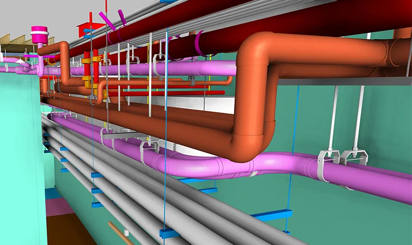
For MEP-intensive facilities, Endeion can create models of visible ductwork, piping, equipment, conduits, cable trays and related services. These outputs provide a reliable base for retrofit planning, building services coordination, access reviews and updates to existing mechanical or utility layouts.
Civil, Site and Terrain Modeling
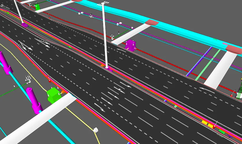
Where the scan and scope support it, models may include site surfaces, terrain, visible utilities, external structures, and selected surrounding features. This can assist civil contractors and infrastructure teams with existing-condition documentation, grading studies, site modifications, and expansion planning.
Point Cloud to Mesh and 3D Modeling
Not every project requires parametric BIM objects. Endeion also supports point cloud to 3D modeling services for mesh, solid or reference model requirements. A mesh can be useful for irregular geometry, complex surfaces, heritage features, equipment envelopes or visualization where conventional BIM families would not be the most efficient representation.
Deliverables of Point Cloud to BIM Services
Deliverables are selected according to the project objective, available scan coverage and required model accuracy. A typical point cloud to BIM service may include:
| Deliverable | Typical Project Use |
|---|---|
| Architectural, structural or MEP BIM model | Existing-condition reference, renovation planning, coordination and documentation |
| Federated or discipline-specific model package | Multidisciplinary review and controlled model exchange |
| As-built floor plans | Space planning, renovation layouts and record documentation |
| Elevations and sections | Design review, measured references and drawing production |
| Mesh or 3D reference model | Irregular geometry, visualization or specialized analysis |
| Model views and selected schedules | Project-specific review and information extraction |
Our Point Cloud to BIM Workflow
- Scope and intended-use review: We identify the required disciplines, project areas, output formats, accuracy expectations, drawing needs and downstream uses.
- Point cloud and reference-file review: The team checks scan registration, coverage, density, orientation and available drawings to identify gaps that may affect modeling.
- BIM setup: Levels, grids, coordinates, shared references, naming standards and client templates are established before model production.
- Model development: Required architectural, structural, MEP, civil or mesh elements are created using the point cloud as the primary geometric reference.
- Scan-to-model checking: Model geometry is compared with the point cloud in agreed review areas, and visible discrepancies are corrected within the project’s tolerance.
- Drawing and output preparation: Approved plans, elevations, sections, views or other deliverables are generated from the model.
- Final quality review and delivery: Files are checked for organization, completeness, coordinates, model usability and alignment with the agreed scope.
The service normally begins after the client provides registered point cloud data and available reference documents. On-site scanning, scan registration, data cleanup, or survey certification should be discussed separately when required because these activities are not automatically part of every modeling assignment.
LOD, Accuracy and Model Acceptance
Level of Development and Level of Accuracy describe different aspects of a point cloud project. LOD defines how developed and information-rich a BIM element must be for its intended use. Accuracy describes how closely the modeled geometry is expected to represent the measured scan data.
Endeion can align models with project-specific LOD and accuracy requirements, including workflows informed by BIMForum and USIBD guidance when requested. The correct requirement depends on the asset, scan quality, and intended decision. A renovation model may require detailed geometry in selected plant rooms, but simpler context modeling in unaffected areas.
Before production, the project team should agree on modeled disciplines, minimum object sizes, tolerance or deviation expectations, excluded or concealed elements, treatment of irregular geometry, and the process for handling incomplete scan coverage. These decisions are more useful than applying a single high LOD label to the entire project.
Applications of Point Cloud to BIM Solutions
- Renovation and remodeling, where existing conditions must be understood before design development
- Retrofit and building-system upgrades, including HVAC, plumbing, electrical and equipment replacement
- As-built documentation for facilities with incomplete, outdated or inconsistent record drawings
- Building expansion and vertical or horizontal additions that must connect to existing construction
- Demolition planning and selective removal studies based on documented visible conditions
- Facility management and maintenance planning supported by organized spatial and asset information
- Heritage, restoration and refurbishment projects involving irregular or difficult-to-measure geometry
- Industrial and infrastructure projects requiring existing-condition models for coordination or modification
Point Cloud to BIM Conversion in US Project Workflows
Endeion supports point cloud to BIM conversion in US project workflows from its Virginia headquarters and global delivery offices. Our team can work with architects, general contractors, subcontractors, engineering consultants, and building owners that need additional BIM capacity without expanding an internal modeling team for every project.
For clients seeking point cloud to BIM conversion services across multiple locations, the workflow can be standardized around agreed templates, Revit families, file naming, view organization, discipline boundaries and review checkpoints. This creates greater consistency while allowing each building or scan area to retain project-specific scope requirements.
Outsourcing Point Cloud Modeling Services
Point cloud outsourcing services can help firms manage large scan datasets, compressed schedules or specialized model requirements without diverting design and construction staff from their core responsibilities. Endeion works as an extension of the client team, following agreed standards and submitting models through defined review stages.
Organizations may use a point cloud to BIM outsourcing service for a single building, a discipline package, selected high-detail zones or a repeated portfolio workflow. When teams outsource point cloud modeling service requirements, the most successful projects begin with a clear responsibility matrix, stable scan data, agreed priorities, and responsive technical review.
Our point cloud to BIM modelling services can also support clients using British or international terminology and documentation conventions. File structure, units, drawing standards, and BIM requirements are confirmed before work starts.
How Point Cloud to BIM Automation Supports Delivery
Point cloud to BIM automation can accelerate parts of data preparation, segmentation, feature recognition, repetitive object placement, and model checking. Automation is particularly helpful when a project contains repeated geometry or large datasets that need consistent processing.
However, automation does not remove the need for experienced modelers. Scan occlusions, irregular construction, partial elements, overlapping services, and unclear boundaries still require human interpretation. Endeion uses suitable tools and structured workflows while retaining technical review for model decisions that cannot be resolved reliably by software alone.
Why Choose Endeion for Point To Cloud BiM Services?
Discipline-Specific Modeling
Our team supports architectural, structural, MEP, civil, and mesh-based outputs, allowing the model scope to match the technical needs of the project.
Revit-Based and Client-Aligned Workflows
Endeion can use client-provided Revit families, templates, naming conventions and BIM standards to create deliverables that integrate more easily with existing project workflows.
As-Built and Renovation Experience
The service is closely connected to Endeion’s as-built drafting, CAD-to-BIM, MEP BIM and BIM coordination capabilities, supporting projects that move from existing-condition documentation into design and construction.
Structured Quality Control
Models are reviewed against the point cloud and agreed project requirements. Limitations caused by missing scan coverage, inaccessible areas, or unsupported assumptions are identified rather than silently modeled as verified conditions.
Flexible Outsourcing Support
Endeion provides a point cloud to BIM modeling solution for one-time assignments as well as scalable project requirements, helping internal teams manage capacity while retaining control of design and approval decisions.
Frequently Asked Questions
What is a point cloud to BIM service?
A point cloud to BIM service converts registered laser-scan or photogrammetry data into organized BIM elements and, when required, related plans, elevations and sections. The model documents visible existing conditions for renovation, retrofit, coordination, as-built records or facility planning.
What information does Endeion need to begin?
Typical inputs include the registered point cloud, project location and units, available drawings, the required model disciplines, intended model use, LOD or accuracy requirements, client standards and the requested deliverables. Scan capture or registration should be identified separately if it is needed.
Can Endeion provide point cloud to BIM modeling services for MEP systems?
Yes. Endeion can model visible ductwork, piping, equipment, conduits, cable trays and related building services when the scan coverage and scope support those elements. The model can assist with retrofit planning, coordination, and as-built documentation.
Does every project require LOD 500?
No. LOD 500 should only be used when field verification and record-model requirements are clearly defined. Many projects are better served by a targeted LOD and accuracy level based on the intended design, coordination, or documentation of use.
What is the difference between a BIM model and a mesh model?
A BIM model uses organized objects with defined categories and properties. A mesh represents surfaces through connected geometry and may be more suitable for irregular shapes or visualization. Some projects use both BIM for standard building systems and mesh geometry for complex features.
Can Endeion support point cloud to BIM conversion in the US?
Yes. Endeion supports US projects from its Virginia headquarters with additional delivery resources in Canada and India. The project workflow, standards, coordination process, and file exchange requirements are agreed during scoping.
How is point cloud to BIM pricing calculated?
Pricing is based on project size, scan condition, modeled disciplines, complexity, required accuracy, LOD, drawing outputs, schedule, and review needs. Endeion reviews the available files before preparing a scope-based quotation.
Can we outsource point cloud modeling while keeping design control in-house?
Yes. Clients can retain responsibility for design decisions, approvals, and site verification while Endeion handles the agreed modeling and documentation scope. Defined review checkpoints help the outsourced team stay aligned with the client’s project requirements.
Does automation create the complete BIM model?
Automation can assist with data processing and repetitive tasks, but experienced review is still required. Real buildings contain occlusions, irregular geometry, and incomplete information that must be interpreted within the project’s scope.
Why choose Endeion’s point cloud to BIM solutions?
Endeion combines scan-based modeling with architectural, structural, MEP, civil, as-built, and BIM coordination experience. The team follows client standards, focuses on modeling on the intended project use, and clearly identifies data limitations that affect the final deliverables.
Areas We Serve
- Alabama
- Albany
- Arizona
- Atlanta
- Augusta
- Bakersfield
- Boston
- Brownsville
- Buffalo
- California
- Charlotte
- Chicago
- Cleveland
- Colorado
- Columbia
- Columbus
- Concord
- Connecticut
- Dallas
- Florida
- Georgia
- Hawaii
- Houston
- Illinois
- Indiana
- Kansas
- Kentucky
- Los Angeles
- Louisiana
- Maine
- Maryland
- Massachusetts
- Mississippi
- Missouri
- Montana
- Nebraska
- Nevada
- New Hampshire
- New Mexico
- New York
- North Carolina
- North Dakota
- Ohio
- Oklahoma
- Oregon
- Orlando
- Pennsylvania
- Portland
- Rhode Island
- Seattle
- South Carolina
- Texas
- Vermont
- Virginia
- Washington
- West Virginia
- Wisconsin