



Table of Contents
Transportation infrastructure forms the backbone of economic development, regional connectivity, and urban expansion. Roads and bridges are not merely physical links between destinations; they are strategic assets that support commerce, mobility, public safety, and long-term national growth.
As infrastructure projects grow in scale and complexity, traditional design and construction methodologies often struggle to manage the vast amount of data, coordination requirements, and lifecycle performance expectations. Building Information Modeling (BIM) has emerged as a transformative solution that enables digital precision, collaboration, and lifecycle intelligence across road and bridge projects.
BIM in transportation infrastructure extends far beyond three-dimensional modeling. It represents a comprehensive digital process that integrates geometric design, geographic data, engineering calculations, construction sequencing, cost management, and asset information into a unified environment. By enabling a data-rich, model-based workflow, BIM enhances planning accuracy, reduces rework, improves safety, and ensures long-term operational efficiency for road and bridge infrastructure.
Understanding BIM in the Infrastructure
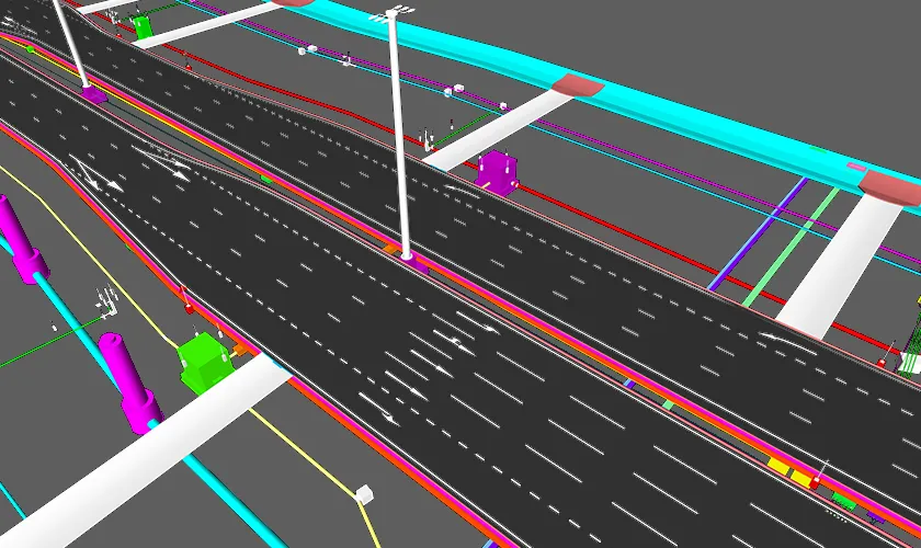
Unlike vertical construction projects such as residential or commercial buildings, road and bridge projects involve linear corridors that stretch across diverse terrains, environmental zones, and urban conditions. Infrastructure BIM integrates topographical data, geotechnical information, environmental constraints, and traffic patterns into coordinated digital models. This integration allows engineers and planners to analyze real-world conditions before construction begins, significantly reducing uncertainties and design conflicts.
Bridge Information Modeling (BrIM), a specialized extension of BIM, focuses on the structural and performance requirements unique to bridges, including load distribution, stress behavior, foundation conditions, and long-span coordination. Infrastructure BIM also frequently integrates Geographic Information Systems (GIS), allowing spatial analysis and terrain modeling to be embedded directly into the project workflow. This comprehensive approach transforms road and bridge development into a predictive and data-driven process rather than a reactive one.
Applications of BIM in the Planning Phase
The planning phase of road and bridge projects determines long-term project success, and BIM plays a critical role in enhancing decision-making during this stage.
Feasibility Studies and Site Analysis
BIM enables the integration of survey data, LiDAR scans, drone imagery, and geotechnical investigations into a centralized digital model. Engineers can evaluate soil conditions, groundwater levels, terrain slopes, and environmental constraints with high accuracy. Traffic simulations can be conducted within the digital environment to predict congestion impacts and optimize route alignments. Environmental impact assessments benefit from visual simulations that demonstrate potential ecological effects, allowing planners to select alternatives that minimize disruption.
Conceptual and Preliminary Design
During conceptual development, BIM supports 3D alignment modeling for roads and highways, enabling designers to test multiple routing options and analyze cost implications early in the process. For bridges, conceptual models can simulate span lengths, support placements, and load behavior before detailed structural calculations begin. This early-stage modeling improves cost estimation accuracy and reduces the risk of expensive redesigns later in the project lifecycle.
Stakeholder Communication and Approvals
Public infrastructure projects often require approvals from government agencies, regulatory bodies, and local communities. BIM-generated visualizations provide realistic representations of road corridors, interchanges, and bridge structures, improving transparency and facilitating informed decision-making. These visual models significantly enhance stakeholder confidence and streamline the approval process.
Applications of BIM in the Design Phase
The design phase is where BIM delivers substantial coordination and accuracy benefits across multidisciplinary teams.
Detailed Roadway Design
BIM enables precise modeling of horizontal and vertical alignments, superelevation calculations, pavement structures, drainage networks, and signage systems. Designers can integrate stormwater management systems and culverts directly into the road model, ensuring proper water flow and compliance with environmental regulations. The model-based approach ensures that every component interacts correctly within the broader infrastructure system.
Bridge Information Modeling (BrIM)
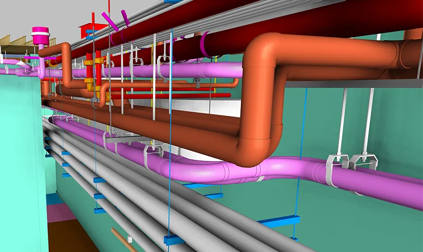
For bridge projects, BIM supports detailed modeling of decks, piers, abutments, cables, bearings, and foundations. Engineers can conduct structural load simulations and stress analyses within the model, validating performance under dynamic conditions such as heavy traffic, wind loads, and seismic events. Clash detection capabilities ensure that structural components do not interfere with utilities, reinforcement systems, or temporary construction elements.
Interdisciplinary Coordination
Road and bridge projects involve collaboration between structural engineers, geotechnical specialists, transportation planners, environmental consultants, and construction teams. BIM creates a centralized data environment that ensures all stakeholders work with synchronized information. Automated clash detection identifies design conflicts before construction begins, significantly reducing rework and costly on-site modifications.
Applications of BIM in the Construction Phase
The transition from design to construction introduces logistical and operational complexities that BIM helps manage effectively.
4D Construction Sequencing
By linking model elements to project schedules, BIM enables 4D simulations that visualize construction activities over time. Contractors can plan traffic diversions, temporary supports, staged bridge deck installations, and material deliveries within a virtual environment. This proactive sequencing reduces project delays and enhances coordination between contractors and subcontractors.
Quantity Takeoff and Cost Management (5D BIM)
BIM automates quantity extraction for materials such as concrete, steel reinforcement, asphalt, and drainage components. Accurate digital takeoffs support precise cost estimation and real-time budget tracking. By integrating cost data into the model, project managers can monitor financial performance and identify variances before they escalate into major overruns.
Risk Management and Safety Planning
Construction risk mitigation benefits significantly from BIM simulations. Temporary structures, scaffolding systems, and lifting operations can be digitally analyzed to ensure safe execution. Hazard identification within the model supports proactive safety planning and reduces workplace incidents.
On-Site Collaboration and Data Access
Cloud-based BIM platforms enable field teams to access updated models in real time using tablets and mobile devices. This ensures that on-site decisions align with the latest design revisions and minimizes communication breakdowns between office and field personnel.
Applications of BIM in Operation and Maintenance
Infrastructure projects extend far beyond construction completion, and BIM continues to deliver value during the operational phase.
Asset Information Management
BIM models serve as digital repositories containing component-level data such as material specifications, maintenance schedules, and warranty information. Asset managers can retrieve detailed information instantly, improving maintenance planning efficiency.
Structural Health Monitoring
Integration of sensors and IoT devices with BIM models supports real-time monitoring of bridge performance, including vibration patterns, stress behavior, and environmental impacts. This data-driven approach enables predictive maintenance strategies that reduce long-term repair costs.
Lifecycle Cost Optimization
By analyzing historical performance data and maintenance trends, asset owners can forecast rehabilitation needs and optimize lifecycle budgets. BIM transforms infrastructure from a static asset into a dynamic, continuously monitored system.
Sustainability and Environmental Applications
Sustainability is increasingly central to infrastructure development, and BIM supports environmentally responsible decision-making.
Carbon footprint analysis can be integrated into material selection processes, allowing designers to compare environmental impacts of various construction methods. Flood simulation models improve stormwater management and reduce long-term climate risks. Additionally, resilience modeling helps engineers design infrastructure capable of withstanding extreme weather conditions and evolving environmental challenges.
Key Benefits of BIM in Transportation Infrastructure
Improved Design Accuracy
BIM enables precise 3D modeling integrated with real-world data such as terrain, geotechnical inputs, and utilities, significantly reducing design inconsistencies and ensuring technically sound infrastructure solutions.
Reduced Rework and Construction Errors
Through automated clash detection and coordinated multidisciplinary models, BIM identifies conflicts before construction begins, minimizing costly on-site corrections and schedule delays.
Enhanced Interdisciplinary Collaboration
A centralized digital model allows engineers, contractors, and stakeholders to work within a shared data environment, improving communication, coordination, and overall project transparency.
Faster Regulatory Approvals
High-quality visualizations and data-rich models improve stakeholder understanding, streamline review processes, and accelerate government and regulatory approvals.
Optimized Cost Control (5D BIM)
Integrated quantity takeoffs and cost data provide accurate budgeting, real-time financial tracking, and better forecasting, helping control overruns and improve financial predictability.
Improved Safety Performance
Construction sequencing simulations and risk assessments within BIM models support proactive safety planning, reducing hazards and improving worker and public safety.
Better Long-Term Asset Management
BIM serves as a comprehensive digital asset database, supporting maintenance planning, lifecycle tracking, performance monitoring, and long-term infrastructure sustainabilit
Challenges in BIM Implementation
Large and Complex Data Management
Infrastructure BIM models incorporate extensive terrain data, geotechnical information, utilities, structural components, and lifecycle details. Managing, storing, and updating these large datasets requires robust data governance and digital infrastructure.
Software Interoperability Issues
Road and bridge projects often involve multiple software platforms across disciplines. Ensuring seamless data exchange and maintaining model integrity between systems can be technically challenging without standardized workflows.
Skill Gaps and Training Requirements
Effective BIM implementation demands skilled professionals who understand modeling standards, coordination protocols, and data management practices. Continuous training and upskilling are necessary to maintain project efficiency and quality.
Resistance to Digital Transformation
Organizations accustomed to traditional workflows may resist adopting BIM due to cultural inertia, fear of change, or uncertainty about return on investment. Strong leadership and clear communication are essential to drive acceptance.
Need for Structured Planning and Expert Guidance
Successful BIM adoption requires a clear roadmap, governance framework, and measurable performance metrics. Expert consulting and strategic implementation planning ensure long-term scalability and sustainable digital transformation.
The Future of BIM in Road and Bridge Projects
Integration with Digital Twin Technology
The evolution of BIM is increasingly aligned with digital twin systems that replicate physical infrastructure assets in real time, enabling continuous performance tracking, scenario testing, and data-driven operational decision-making.
Artificial Intelligence and Predictive Analytics
Artificial intelligence enhances BIM capabilities by analyzing historical and real-time data to predict structural performance, maintenance requirements, traffic behavior, and potential risks before they escalate into critical failures.
Smart City Connectivity
As urban environments become digitally interconnected, BIM models integrate with smart city platforms to support intelligent traffic management, infrastructure monitoring, and coordinated urban planning strategies.
Real-Time Performance Monitoring
Future infrastructure systems will rely on sensor-integrated BIM environments that continuously monitor structural health, environmental conditions, and usage patterns to enhance resilience and operational reliability.
Foundation of Advanced Digital Ecosystems
BIM will continue to serve as the foundational digital framework that supports data interoperability, lifecycle management, and sustainable infrastructure development within increasingly intelligent and automated ecosystems.
Conclusion
Applications of BIM in road and bridge projects span the entire lifecycle, from early feasibility analysis to long-term asset management. By integrating design precision, construction efficiency, financial transparency, and predictive maintenance capabilities, BIM transforms infrastructure delivery into a coordinated and data-driven process. Organizations seeking structured, scalable, and performance-oriented BIM implementation for transportation infrastructure can benefit from the specialized expertise offered by Endeion, ensuring sustainable growth and long-term infrastructure excellence.
FAQs
How does BIM improve road and bridge project efficiency?
BIM improves efficiency by integrating design, scheduling, cost estimation, and asset data into a coordinated digital model, reducing errors, minimizing rework, improving collaboration, and enabling data-driven decision-making throughout the project lifecycle.
What is Bridge Information Modeling (BrIM)?
Bridge Information Modeling is a specialized application of BIM focused on bridge structures, enabling detailed modeling of decks, piers, foundations, load simulations, clash detection, and lifecycle performance monitoring.
Can BIM help reduce cost overruns in infrastructure projects?
Yes, BIM supports accurate quantity takeoffs, real-time cost tracking, 4D scheduling simulations, and early clash detection, which collectively reduce unexpected changes, delays, and budget overruns in complex infrastructure projects.
How does BIM support maintenance of roads and bridges?
BIM creates a centralized digital asset database containing component data, inspection records, and performance metrics, enabling predictive maintenance, improved lifecycle planning, and better long-term infrastructure management.

